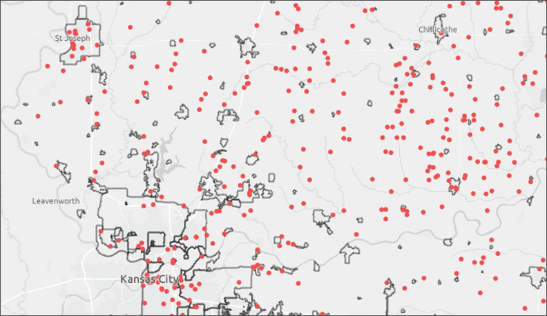
We’ve added the new urban areas to the Geocorr 2022 application this month.
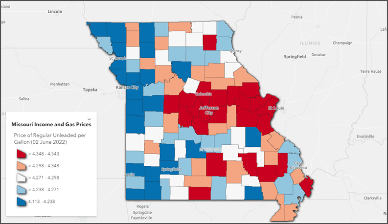
There are two new options in Geocorr for source or target geographies. Urban areas are the complete areas with Census Bureau codes; for example, the Columbia, MO urban area with UA code 18937. Urban/rural portion uses a binary designation (“U” or “R”) for each block to calculate the fraction of urban and rural population for any other geography.
There are significant changes to the urban/rural classifications for the 2020 Census. One major change is that we no longer have two different types of urban area. Previously, there were urbanized areas and urban clusters (collective called urban areas), but now there are only urban areas of a single type. In addition, the method for defining these areas is much more complex than before. The short version of the new definition, from the Bureau’s Urban and Rural page, is:
For the 2020 Census, an urban area will comprise a densely settled core of census blocks that meet minimum housing unit density and/or population density requirements. This includes adjacent territory containing non-residential urban land uses. To qualify as an urban area, the territory identified according to criteria must encompass at least 2,000 housing units or a population of at least 5,000.
Among other factors, the longer definition includes:
- Initial criteria for blocks: >= 425 dwelling units/ square mile, or substantial impervious surface >= 20%, or group quarters facility and >= 500 population/square mile.
- Candidate blocks are then assembled into urban areas:
- Start with an initial contiguous core area with >= 500 dwelling units.
- Add nearby noncontiguous urban blocks: any number of “hops” <= 0.5 mile over land area, and up to one “jump” of 0.51 – 1.5 miles over land area.
- Combined urban area must have at least 5,000 population or at least 2,000 housing units.
- Enclaves or surrounded areas are added (or removed), and additional qualifying criteria (airports, indentations, high-employment areas, impervious areas) are applied.
For a complete list of elements comprising the new definition, refer to the . See also this helpful PDF, Differences between the Final 2020 Census Urban Area Criteria and the 2010 Census Urban Area Criteria, for more information about the changes.
Please report any errors to Glenn Rice (riceg@missouri.edu).