MCDC News and Updates

Story Map

The Physiographic Regions of Missouri

The state of Missouri boasts a diverse natural landscape, including vast forests, rolling plains, sprawling river systems, highlands, and swamps. In this month’s story map, MCDC’s partners at the Missouri Spatial Data Information Service (MSDIS) classify these natural features into regions and compare their boundaries to census data provided by MCDC.

Missouri Census Data Center frequently works with MSDIS on mapping and data projects. MSDIS is a spatial data retrieval and archival system offering many mapping resources, primarily focused on the state of Missouri.

Story Map

Missouri County-Level Health Factors

The Missouri Public Health Management System (MOPHIMS) County-Level Study surveys approximately 50,000 Missouri residents to estimate health-related measures throughout the state. Questionnaires gauge behavioral risk factors related to health and document participants’ reports of chronic disease diagnoses.

This month, MCDC’s partners at the Missouri Spatial Data Information Service (MSDIS) present county-level maps showing results of the 2016 study for diabetes, high blood pressure, and kidney disease.

Missouri Census Data Center frequently works with MSDIS on mapping and data projects. MSDIS is a spatial data retrieval and archival system offering many mapping resources, primarily focused on the state of Missouri.

Story Map

Missouri Unemployment Rates, 2020-2021

This December, our partners at the Missouri Spatial Data Information Service (MSDIS) present a swipe map comparing unemployment rates in Missouri counties during the years 2020 and 2021. This is a follow-up to the previous MSDIS map comparing Missouri county unemployment  between 2000 to 2020.

The left side of the swipe map shows unemployment by county for 2020, and the right side shows the rates for 2021.

Missouri Census Data Center frequently works with MSDIS on mapping and data projects. MSDIS is a spatial data retrieval and archival system offering many mapping resources, primarily focused on the state of Missouri.

Story Map

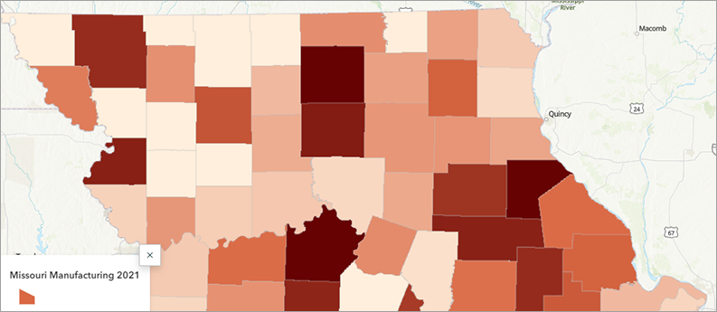
Manufacturing Employment in Missouri over the Past Decade


The manufacturing sector is the fifth largest employer in the United States and the third largest in Missouri (after health care and retail trade). This month, our partners at the Missouri Spatial Data Information Service (MSDIS) examine how manufacturing employment has changed in Missouri counties between 2011 and 2021 using County Business Patterns data from MCDC and the U.S. Census Bureau. These maps show us how important manufacturing is (and isn’t) in certain counties in Missouri.

Missouri Census Data Center frequently works with MSDIS on mapping and data projects. MSDIS is a spatial data retrieval and archival system offering many mapping resources, primarily focused on the state of Missouri.
Story Map

Missouri Unemployment Rates over Time

This month, our partners at the Missouri Spatial Data Information Service (MSDIS) present a swipe map showing changing patterns of unemployment in Missouri across two decades.

The left side of the swipe map shows unemployment rates by Missouri county for 2000, and the right side shows the rates for 2020. Clicking on any county will show basic employment and workforce stats for the selected county and year.

Missouri Census Data Center frequently works with MSDIS on mapping and data projects. MSDIS is a spatial data retrieval and archival system offering many mapping resources, primarily focused on the state of Missouri.

Story Map

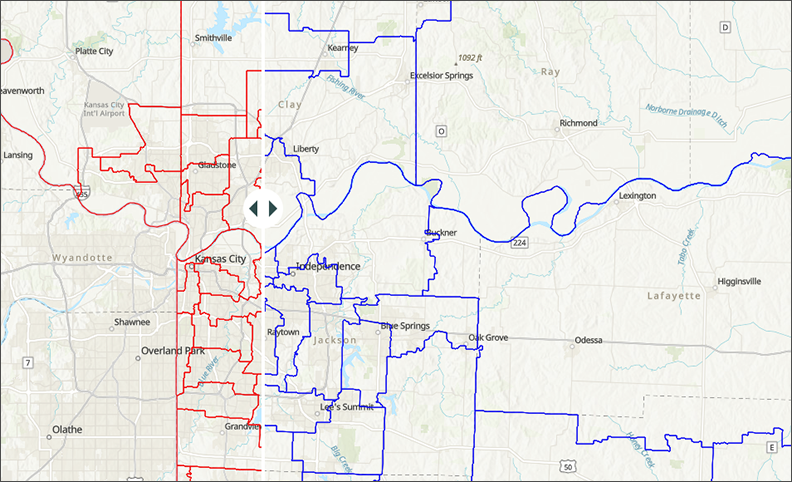
Missouri’s Changing Legislative Boundaries

This month, our partners at the Missouri Spatial Data Information Service (MSDIS) present a set of “swipe maps” showing how the Missouri House and Senate district boundaries changed after the 2020 US Census.

The red outlines on each map (the left side of the swipe tool, in this case) indicate the new, post-2020 districts, and the blue outlines represent the previous boundaries. Clicking on any district will show the district number and, for the newer boundaries, the current office holder.

Missouri Census Data Center frequently works with MSDIS on mapping and data projects. MSDIS is a spatial data retrieval and archival system offering many mapping resources, primarily focused on the state of Missouri.
Story Map

County-to-County Migration in Missouri

This month’s story map, created by Morgan Hurt of the Missouri Spatial Data Information Service, examines recent inward and outward migration to and from Missouri counties.

The data comes from the 2015-2019 American Community Survey — specifically, county-to-county migration flows, a special tabulation created by the ACS program. This data is not released every year, which is why we don’t yet have this migration data from the newest ACS data release (2017-2021).

Missouri Census Data Center frequently works with MSDIS on mapping and data projects. MSDIS is a spatial data retrieval and archival system offering many mapping resources, primarily focused on the state of Missouri.

Story Map

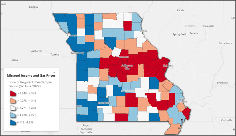
Missouri Median Income vs. Gas Prices

This month’s story map examines trends in Missouri median household income in comparison to gas prices. Data about Missouri income comes from the 2016-2020 American Community Survey via the Missouri Census Data Center, and energy costs data are based off the Consumer Price Index from the United States Bureau of Labor Statistics. County-level gas prices have been taken from the AAA Missouri Gas Prices site, which updates each day.

Missouri Census Data Center frequently works with MSDIS on mapping and data projects. MSDIS is a spatial data retrieval and archival system offering many mapping resources, primarily focused on the state of Missouri.
Story Map

The State of Missouri’s Bridges

According to the  Federal Highway Administration’s National Bridge Inventory, there are about 25,000 bridges in Missouri. Show Me Safe Bridges!, the latest story map from the Missouri Spatial Data Information Service digs into the inventory and maps the best and worst of Missouri’s spans.

Missouri Census Data Center frequently works with MSDIS on mapping and data projects. MSDIS is a spatial data retrieval and archival system offering many mapping resources, primarily focused on the state of Missouri.
Story Map

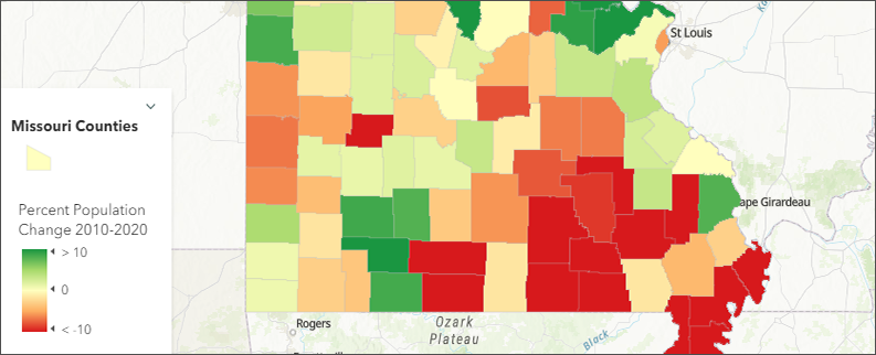
Census 2020 and Missouri’s Changing Population

Last year, the Missouri Spatial Data Information Service (MSDIS) and MCDC brought you several interactive applications that focused on the US Census. We looked at what kinds of public services depend on an accurate census count for the proper distribution of funds and we explored the racial geography of Missouri at a county level. This was all in expectation of the release of the highly anticipated 2020 US Census.

Well, dearest friends and fellow map enthusiasts, the 2020 Census data is here. Let’s have a closer look at Missouri population changes since 2000 and 2010.

Missouri Census Data Center frequently works with MSDIS on mapping and data projects. MSDIS is a spatial data retrieval and archival system offering many mapping resources, primarily focused on the state of Missouri.